Context
Although artisanal mining in Mali has recently accelerated, there is still a lack of reliable data on the sector. Official statistics suggest that annual artisanal production has remained stable since 2015, which is inconsistent with survey reports. Additionally, there are concerns about the accuracy of declarations of production and trade flows of gold.
The World Bank is seeking to objectively assess the extent of gold production in Mali (location, evolution, etc.) to estimate potential resources or losses of public revenue, and to support the Malian administration in orienting its future policies in the mining sector.
Project description
Geo212 produced a geospatial database of 1,387 industrial, semi-industrial and small-scale extraction areas (863 km²) as at end-2022.
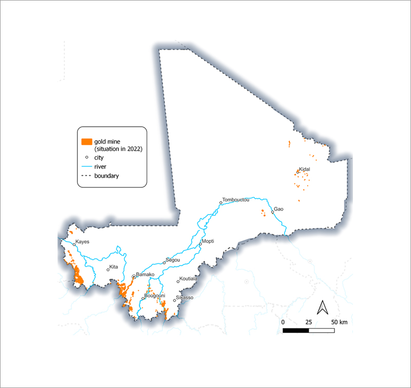
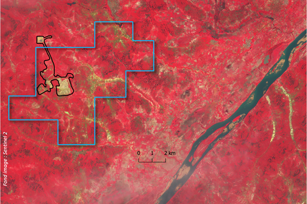
Gold Mining inventory – 2022 (Geo212)
This accurate inventory was carried out by cross-referencing open and commercial sources: reports from previous studies on the mining sector in Mali, local press and social networks, open source mapping data, and satellite images. This information was cross-referenced with geological data and analyzed by an expert geologist to orient the location of the gold production zones.
Gold mining sites were mapped using Maxar satellite imagery combined with recent Sentinel 2 or Sentinel 1 MR imagery, to produce a status report to the end of 2022.
Satellite imagery was also used to map the situation in 2016 and depict the evolution of mining sites between 2016 and 2022.
Geo212 has carried out this spatial and statistical analysis of site changes between 2016 and the end of 2022. This evolution analytic was calculated and mapped by commune, by concession and by 10 km grid. The 2022 mining footprints have been compared with the mining permits granted, highlighting mines that overstep their operating perimeters.
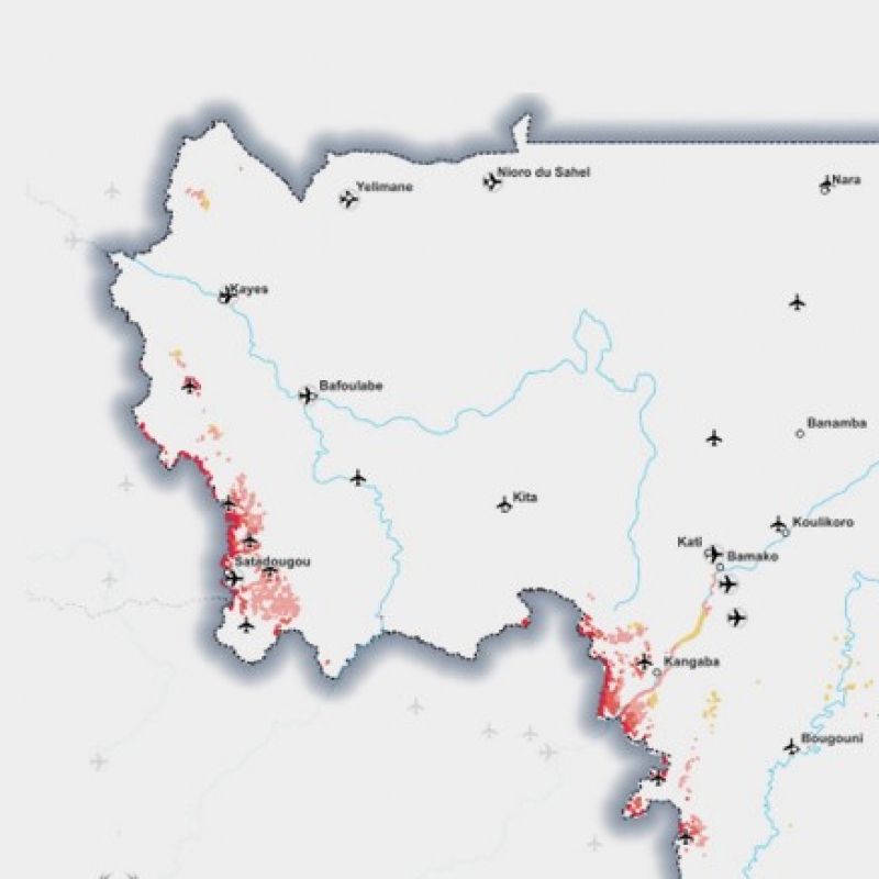
A final spatial analysis highlighted the controllability/"fragility" of each mine in relation to its environment. To achieve this, the distances from each mine site to particular objects such as roads, airports, borders and customs posts were calculated, and a synthetic indicator of the controllability/"fragility" of each mine was calculated. This indicator provides an overall view of the most fragile mines and their potential gold leaks and may support a policy of redeploying control points or customs posts.
The study concluded with a methodological summary report and proposed roadmap for the creation of a permanent "observatory" to monitor mining activity.
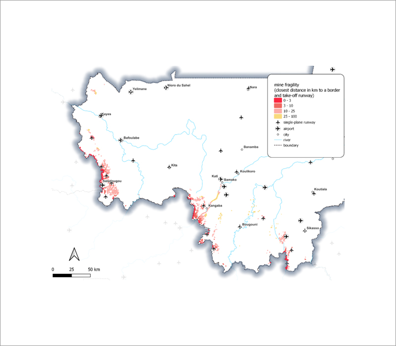
Fragility of mining sites (zoom on west part of Mali) –(Geo212)
Example of mining site overstepping its permit (Geo212)
Contact
For any demonstration or additional information, please, contact
Nicolas Saporiti: nicolas.saporiti@geo212.fr