Context
This project is part of the international partnership dedicated to the creation and sharing of standardized IPHG human geography data, in which the French MinArm is committed, International Program for Human Geography.
Project Description:
The workflow is structured into four main phases (see diagram). It is based on a cross-disciplinary bibliographic review - including academic literature and publications from public institutions, international think tanks, strategic research centers, and specialized media. It also incorporates data compiled by Geo212 on the study area, alongside open-source cartographic and statistical resources.
Geo212: analysis of ethnies, languages, religions, demography and economy, political and security issues of a area
1. Source Search
- Inventory
- Cross-checking of information
- Qualification according to IPHG standard
2. Problem-Based Regional Synthesis
- Integration of information
- Analysis framework design
- Anchoring in the Geography of the Area
3. Collection in a GDB
- Digitalisation of vector base map
- Collection of semantic information in the GDB
4. Mapping
- Thematic map design
- Map layout (paper format and digital formats - GeoTIFF, GeoPDF, StoryMap)
The first phase of the project is dedicated to analyzing the geographical characteristics and key issues of the study area, as well as identifying and selecting the most relevant sources for the various human geography themes defined within the project framework. This phase result is a curated inventory of relevant and qualified sources, which will serve as a foundation for building the project’s database.
Based on this first stage, the key information is used to produce a problem-based regional synthesis, focusing on the study area.
The third phase focuses on populating the GeoDataBase. It begins with a digitization stage, during which a vector framework is developed to provide the cartographic foundation layer for the multithematic datasets (such as ethnolinguistic distribution, major economic infrastructures, zones of influence, and rear bases of various stakeholders, etc.).
In the next step, attribute data are integrated into the digitized layers, using the sources listed in the qualification table. All data are collected in English and comply with the IPHG’s standards. Before dissemination, the final database undergoes qualification and validation process.
The final phase of the project involves the production of a series of thematic maps that visualize the information contained in the GeoDatabase and support geopolitical synthesis. These maps are designed to enable a multidimensional interpretation of the study area and to provide geographical insights addressed by the project. Map design is tailored to suit a range of formats, depending on the project requirements - including printed outputs (A3 and A1), static digital formats (GeoTIFF, GeoPDF) or interactive dashboards, and dynamic products such as StoryMaps.
This methodology has been applied in several use-cases accross various regions including the Horn of Africa SOPSEA 2022, the Gulf of Guinea FEIGG 2023, and the Arabian Peninsula YEMEN 2024, and for different purposes/analysis, such as political instability, economic investments and influence, ethnical conflicts, etc. Examples of these analyses can be accessed via the links above.
The use-cases can be delivered in French or in English.
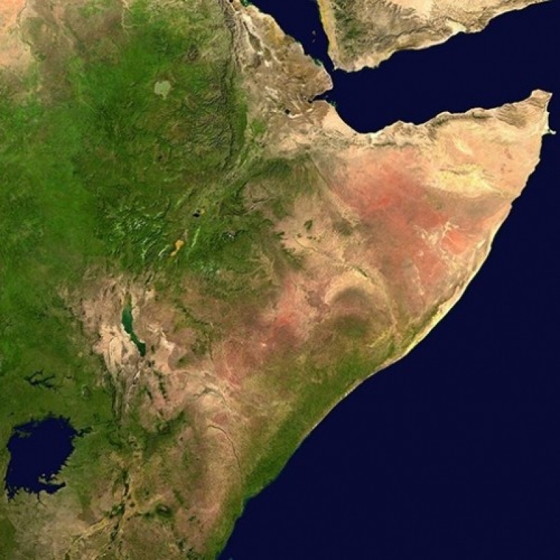
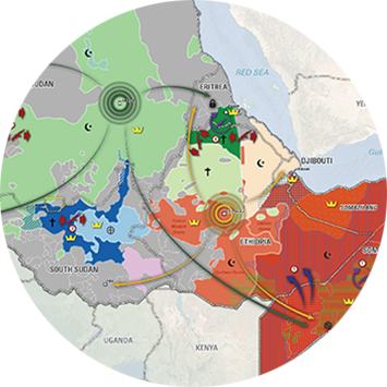
SOPSEA 2022
Ethnolinguistic mosaic in East Africa and Their Impact on the Stability of the Horn of Africa. Download PDF description.
FEIGG 2023
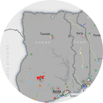
Analysis of foreign economic influences in three countries of the West African Sub-Region. Download PDF description.
YEMEN 2024
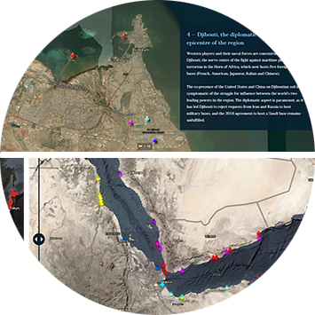
Assessment of Geopolitical Power Dynamics in the Bab-el-Mandeb Strait Region: Analysis of the Actors Involved in the Yemeni Conflict and Their Coastal Positions. Download PDF description.
Contact
For further information, please contact Nicolas Saporiti: nicolas.saporiti@geo212.fr